TRAIL MAP

High Difficulty

Distance

Elevation gain

Duration
(estimado en verano)

How to get there

![]()
![]()
HOW TO GET THERE
From downtown Bariloche:
Bus: Line 20, descend at Puerto Pañuelo, Llao Llao.
SUBE card needed to pay bus fare. Check timetable.
Turisur, a travel agent, offers the transfer to the Port.
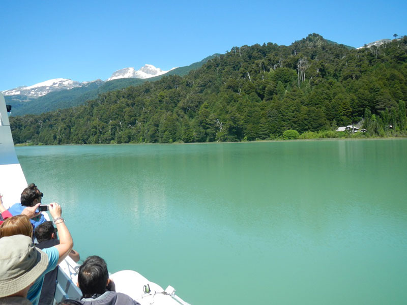
Navigation from Puerto Pañuelo to Puerto Blest, then a short bus ride (3km.) with the same company Turisur to Puerto Alegre, where another boat will cross the Frias Lake to Puerto Frias.
Catamaran departure timetable:
- Puerto Pañuelo – Puerto Blest:
10 hs. all year round. Be at the port at 9 hs. - Puerto Blest – Puerto Pañuelo:
November 1st through end March: 18.30 hs. – April 1st to end October: 16.30 hs.
The entrance fee to the National Park and the boarding fee must be paid at the port prior to boarding.
![]()
![]()
![]()
![]()
![]()
![]()
SERVICES
Turisur
www.turisur.com.ar
The navigation on lake Nahuel Huapi and Lake Frias
This is the only company which has a concession to navigate from Puerto Pañuelo (Llao Llao) to Puerto Blest with a daily service. The same company offers the Lake Frias navigation, this service has an extra cost. Although you only use one way of this ride you still must pay the full fare.
For this part of the navigation you may hire a private service, though you must make sure that the company is licensed in the National Park.
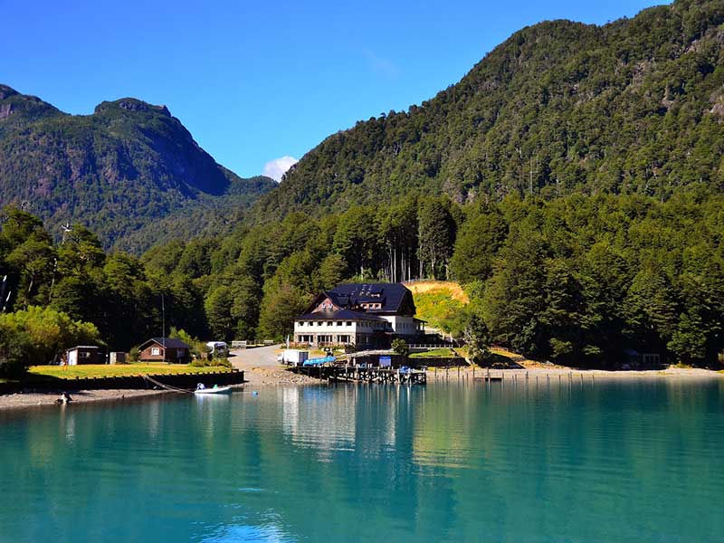
Hotel Puerto Blest
www.hotelpuertoblest.com.ar
Low season. From Easter weekend till December 14th. During this period there are days that the hotel may be closed. The rest of the year is considered High season. If you have a reservation at the hotel you have the boat ride included in the cost (same if you use a return trip or only one way).
- This trail can only be done if you sleep at the Puerto Blest Hotel, so you must have a reservation at the hotel beforehand.
- Camping is not allowed at Puerto Blest nor at Puerto Frias.
- Bear in mind what season you are in, daylight hours, when planning your trip. Also be aware that in the rainy season the trails get very muddy and slippery making it a lot harder.
![]()
![]()
![]()
DESCRIPTION
This trail has a rich history behind it. Back in the day it was used very often to connect Chile and Argentina, the pass was called “Paso de los Raulies”. This pass was replaced by the International Pass Perez Rosales, known as the “Lakes crossing”, made only for tourist interests, connecting two natural protected areas: Vicente Perez Rosales in Chile with Nahuel Huapi National Park from Argentina.
The trail starts 1.5 km. up from the Customs Office at Puerto Frias on the road to Chile. Here you will find the sign for the trail heading to Puerto Blest. The first 2 km. are a gradual ascent on a recently marked trail so look out for the markings.
First you cross the Pangue lagoon and then the Nails lagoon. Around 6 km. from the start of the trail, half way between the lagoons there is a short detour (1 km. round trip) to one of the International Boundary Cairns.
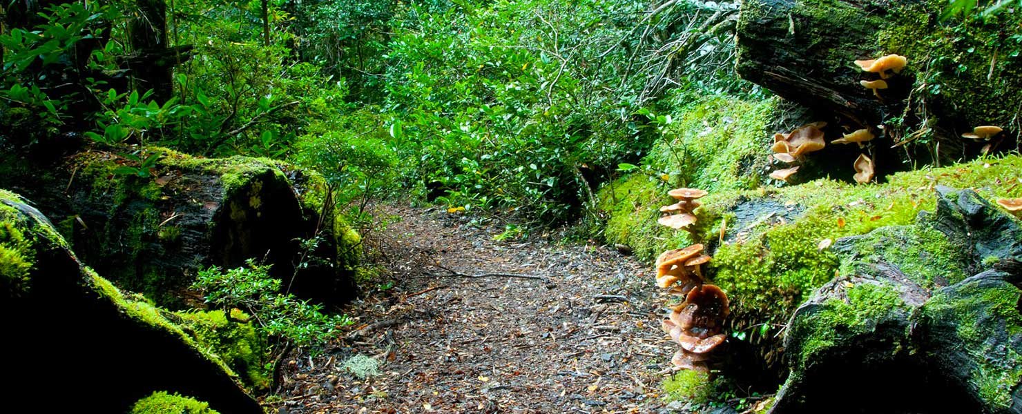
Here the trail begins to slowly descend towards Puerto Blest, through a Valdivian Forest, characteristic of the area, very wet and lots of vegetation. There will be many creek crossings which should not be very difficult out of the rainy season or snowmelt.
The last part connects with the trail going from Puerto Blest to Puerto Cántaros, very close to the shore.
To improve the trekking experience, it is recommended to contact a Mountain Guide authorized by the AAGM (Argentine Association of Mountain Guides)
PHOTO GALLERY