TRAIL MAP

Moderate Difficulty

Distance

Elevation gain

Duration

How to get there

![]()
![]()
![]()
HOW TO GET THERE
From downtown Bariloche:
Bus: In summer season there is a minibus transfer to Pampa Linda. Get off at “Los Césares”, the trailhead is right across the road.
By car: 61 km total. Take route 40 towards El Bolsón, soon after Villa Mascardi at 36 km. there is a right turn off onto a gravel road. Another couple of hundred meters and you are at the Park Rangers Office “Mascardi”, where is the paid entrance fee to the National Park. From here there are 25 km. to Los Césares.
The road between Los Rápidos and Pampa Linda has timetables of restricted one direction:
- One way up: from 10 to 14 hs. from Los Rápidos.
- One way down: from 16 to 18 hs. from Pampa Linda.
- Two way road: from 19:30 to 9 hs.
- From 14 to 19:30 hs you cannot head towards Pampa Linda.
![]()
![]()
![]()
![]()
![]()
![]()
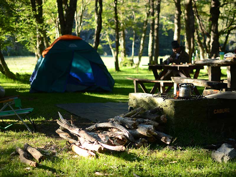
SERVICES
Close to Los Césares:
Camping area “ The 3 Poplars”- No services
Tronador Hotel – Open from November to April
www.hoteltronador.com
At Los Rápidos:
Los Rápidos Campground – Open all year round
www.losrapidos.com.ar/
- It’s a very long hike so leave early, calculate how long it could take and have plenty of daylight hours.
- Pay attention to markings and cairns, it’s a new trail with little use and poor signaling.
- Check the weather and snow at the high part.
- Plan the departure and recovery of the vehicle since the road has one-way traffic schedules.
![]()
![]()
![]()
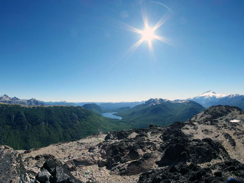
DESCRIPTION
It is the same trail heading up to the waterfall, Los Césares lake and Diego Flores de León peak. Take the left fork at the junctions when going towards Los Rápidos, though well worth a short detour to the waterfall on the first junction.
First part is pretty steep, through the forest, plenty of switchbacks, then up on the ridge, lookout for the cairns to stay on trail. From the summit of the peak it’s a new trail that continues on to Los Rápidos, added to the Huella Andina traverse, it hasn’t been travelled much so pay careful attention. The trail gently contours round and into the forest for the first part. Then it descends rapidly and becomes more marked, soon it gets to a fallen tree trunk, the bridge to cross the Avilés creek.
The last stretch of the trail connects with an existing trail from Los Rápidos to Los Moscos lake, very well marked and takes roughly 20 minutes.
This trail can also be done in the opposite direction. Either way it’s important to leave early and plan on logistics to get back to the starting point as the road has one way regulate hours.
To improve the trekking experience, it is recommended to contact a Mountain Guide authorized by the AAGM (Argentine Association of Mountain Guides)
PHOTO GALLERY