TRAIL MAP

Moderate Difficulty

Distance

Elevation gain

Duration
(return trip)

How to get there

![]()
![]()
![]()
HOW TO GET THERE
From downtown Bariloche:
Bus: In summer season there is a minibus transfer to Pampa Linda. Get off at “Los Césares”, the trailhead is right across the road.
By car: 61 km total. Take route 40 towards El Bolsón, soon after Villa Mascardi at 36 km. there is a right turn off onto a gravel road. Another couple of hundred meters and you are at the Park Rangers Office “Mascardi”, where is the paid entrance fee to the National Park. From here there are 25 km. to Los Césares.
The road between Los Rápidos and Pampa Linda has timetables of restricted one direction:
- One way up: from 10 to 14 hs. from Los Rápidos.
- One way down: from 16 to 18 hs. from Pampa Linda.
- Two way road: from 19:30 to 9 hs.
- From 14 to 19:30 hs you cannot head towards Pampa Linda.
![]()
![]()
![]()
SERVICES
Close to Los Césares:
Camping area “ The 3 Poplars”- No services
Tronador Hotel – Open from November to April
www.hoteltronador.com
- Take an extra pair of shoes, you may have to wade some creeks.
- Camping is not allowed at the lake.
- Fires are not allowed.
![]()
![]()
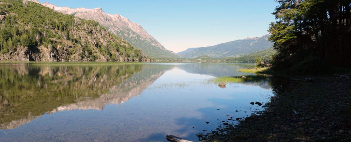
DESCRIPTION
The trail starts at Los Césares on the road to Pampa Linda, close to the shores of Mascardi lake. Follow the trail up to the waterfall, short detour right to see it, then continue up the left detour. At the next detour also go right to the lake (the left heads on up to the Diego Flores de León peak.)
The trail is pretty steep and depending on the season, it may be very muddy and have creeks which need to be waded across.
Trail ends at the lake next to the start of the Los Césares creek.
To improve the trekking experience, it is recommended to contact a Mountain Guide authorized by the AAGM (Argentine Association of Mountain Guides)
PHOTO GALLERY