TRAIL MAP

High Difficulty

Distance

Elevation gain

Duration

How to get there

![]()
![]()
![]()
HOW TO GET THERE
From downtown Bariloche:
Bus: In summer season there is a minibus transfer to Pampa Linda. Get off at “Los Césares”, the trailhead is right across the road.
By car: 61 km total. Take route 40 towards El Bolsón, soon after Villa Mascardi at 36 km. there is a right turn off onto a gravel road. Another couple of hundred meters and you are at the Park Rangers Office “Mascardi”, where is the paid entrance fee to the National Park. From here there are 25 km. to Los Césares.
The road between Los Rápidos and Pampa Linda has timetables of restricted one direction:
- One way up: from 10 to 14 hs. from Los Rápidos.
- One way down: from 16 to 18 hs. from Pampa Linda.
- Two way road: from 19:30 to 9 hs.
- From 14 to 19:30 hs you cannot head towards Pampa Linda.
![]()
![]()
![]()
![]()
![]()
SERVICES
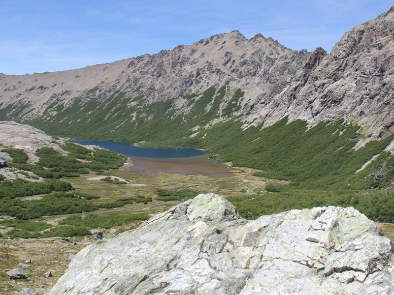
Refugio San Martín (Laguna Jakob) – Abierto todo el año
www.refugiojakob.com.ar
Cercano a Los Césares:
Área de pernocte “Los 3 álamos”. Sin servicios.
Hotel Tronador – Abierto de noviembre a abril.
www.hoteltronador.com
- Groups of more than 10 people are required to make a reservation before heading up.
- Take an extra pair of shoes for wading.
- Fires are not allowed.
- This trail is best to do as of February when there is hardly any snow left.
- It’s a very long hike so leave early, calculate how long it could take and have plenty of daylight hours.
- The Callvuco creek may be very deep and strong and the start of the season.
![]()
![]()
![]()
DESCRIPTION
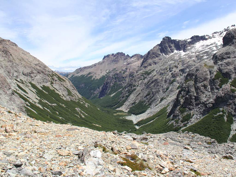
The trail begins next to San Martin Hut up past the camping area and heads south going up over a few series of slabs and rocky outcrops, its well marked with cairns and red dots. The trail detours left towards the Schweitzer pass, the right goes up towards the Iceberg lagoon. From here the trail descends pretty steep down into the drainage basin of the Casalata creek.
Soon the rocky trail ends and you enter the forest which gains height as you get lower in altitude. After an hour there is an emergency camping area. Then the trail gets closer to the creek and there is an important Huella Andina sign indicating to take a left detour. This is a new trail which was set up to avoid a big marshy area and many creek crossings. Be careful as the trail still has lots of roots and bamboo studs peering out.
After roughly another hour, slow going due to the soil characteristics, there is another camping area only in case of emergency. Soon after you need to wade across a you will have the creek on your left for aprox 2 km. when you have to wade back across again.
The trail slowly contours away from the creek until you reach a Cipres forest with views of the Mascardi lake. Here it turns back again and descends down to the creek to cross a final time. Continues contouring around to the Claro river, which may have a strong current in early season. Not far is the hanging bridge over Manso Superior river and next to it is the allowed camping area, fires are not allowed.
There are another 2 km. to get to the road that connects Bariloche and Pampa Linda.
This trail can also be done in the opposite direction, due North, starting at Los Césares, this means it’s all uphill. Look out for the Huella Andina markings as there are many trails and junctions on this first part close to Mascardi Lake.
To improve the trekking experience, it is recommended to contact a Mountain Guide authorized by the AAGM (Argentine Association of Mountain Guides)
PHOTO GALLERY