TRAIL MAP

High Difficulty

Distance

Elevation gain

Duration
(return trip from trailhead)

How to get there

![]()
![]()
![]()
HOW TO GET THERE
From downtown Bariloche:
Bus: In summer season there is a minibus transfer to Pampa Linda which takes roughly 2 hs. Reservation required.
By car: 85 km. total. Take route 40 towards El Bolsón, soon after Villa Mascardi at 36 km., there is a right turn off onto a gravel road. Another couple of hundred meters and you are at the Park Rangers Office “Mascardi”, where is the paid entrance fee to the National Park. From here there are 50 km. to Pampa Linda.
The road between Los Rápidos and Pampa Linda has timetables of restricted one direction:
- One way up: from 10:30 to 14 hs. from Los Rápidos.
- One way down: from 16 to 18 hs. from Pampa Linda.
- Two way road: from 19:30 to 9 hs.
- From 14 to 19:30 hs you cannot head towards Pampa Linda.
![]()
![]()
![]()
![]()
![]()
![]()
SERVICES
IN PAMPA LINDA:
Los Vuriloches campground – Open all year round
www.campinglosvuriloches.com
Hosteria Pampa Linda – Open all year round
www.hosteriapampalinda.com.ar
Albergue Pampa Linda – Open only during summer
www.alberguepampalinda.com
- Hire a Mountain guide is recommended.
- The trail head is the same as Manuel Ojeda Cancino shelter, it can be pretty flooded and very muddy. Take extra shoes as there are lots of creeks and marshy sections.
- It’s a long hike so take into account the hours of daylight.
- There is no camping allowed on the trail so need to hike up and down in the day.
![]()
![]()
![]()
![]()
DESCRIPTION
Following along the gravel road next to the Hosteria Pampa Linda for roughly 400 mts. there is a turn off to the left, this also goes to the Saltillo de las Nalcas, a little further on the road ends and you can park the car. There is a small creek then soon after a bridge to cross the Manso Superior river.
Just before the Saltillo de las Nalcas there is a detour right, a small bridge to cross this creek and the trail continues through the bamboo, same as going up to the “Old Tronador” hut. The trail here may be flooded and very muddy. Trail borders the Cauquen creek for half an hour, then you need to wade through and start ascending.
There will be a sign “Laguna Rosada” and detour left, the trail continues to climb and will cross a creek several times which depending on its amount of water may require to wade through.
Soon the trail levels out and you enter open grass areas, pretty marshy. Look out for markings, mainly vertical wooden rods painted white a meter long high. After entering the forest again and hiking for 15 minutes you reach the ridge.
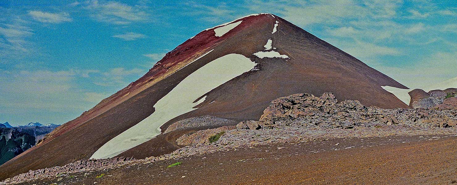
Here the terrain changes to loose slate rocks and sand. The trail is marked with some cairns and red dots on rocks. There is an official border cairn and after a 15 minutes zigzag climb you reach the summit of Cerro Volcánico. From this natural lookout you can view the Osorno and Puntiagudo volcanoes and the Fonck and Hess lakes as well as the south face of Mount Tronador.
Follow the same trail back down or a slight detour to visit the Rosada lagoon.
As there is no camping allowed on the trail you must continue down to Pampa Linda.
To improve the trekking experience, it is recommended to contact a Mountain Guide authorized by the AAGM (Argentine Association of Mountain Guides)
PHOTO GALLERY