TRAIL MAP

High Difficulty

Distance

Elevation gain

Duration

How to get there

![]()
![]()
![]()
HOW TO GET THERE
From downtown Bariloche:
Bus: In summer season there is a minibus transfer to Pampa Linda which takes roughly 2 hs. Reservation required.
By car: 85 km. total. Take route 40 towards El Bolsón, soon after Villa Mascardi at 36 km., there is a right turn off onto a gravel road. Another couple of hundred meters and you are at the Park Rangers Office “Mascardi”, where is the paid entrance fee to the National Park. From here there are 50 km. to Pampa Linda.
The road between Los Rápidos and Pampa Linda has timetables of restricted one direction:
- One way up: from 10:30 to 14 hs. from Los Rápidos.
- One way down: from 16 to 18 hs. from Pampa Linda.
- Two way road: from 19:30 to 9 hs.
- From 14 to 19:30 hs you cannot head towards Pampa Linda.
![]()
![]()
![]()
![]()
![]()
![]()
![]()
![]()
SERVICES
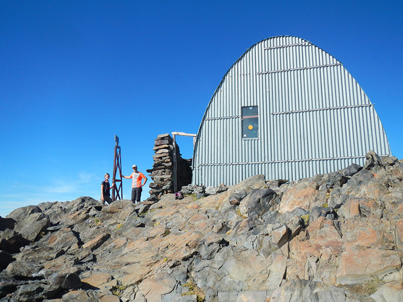
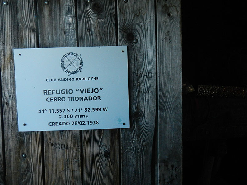
Manuel Ojeda Cancino Hut (“Old” Refuge of Tronador Mountain)
The mountain hut has no services at all, and is used as a bivouac. It can accommodate about 10 people maximum. It is essential to bring a heater.
IN PAMPA LINDA:
Camping Los Vuriloches – Open all year long
https://campingvuriloches.com.ar/
Hostería Pampa Linda – Open all year long
http://www.hosteriapampalinda.com
Albergue Pampa Linda – Open only during summer
www.alberguepampalinda.com
- Have your passport to be able to do your migration paperwork both at Argentine border police and Chilean Carabineros.
- Hire a Mountain guide is recommended.
- It is a long hike so bear in mind daylight hours.
- Take a stove and plenty of clothing as temperatures drop a lot at night.
- Take plenty water.
![]()
![]()
![]()
![]()
DESCRIPTION
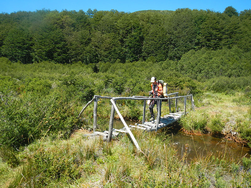
Before you set out of Pampa Linda you must do you migration paperwork at the Border Police office. The trail head is roughly 400 mts. along the road towards Ventisquero Negro, a detour to the left which is also the Trail to Saltillo de las Nalcas (waterfall). There is first a small creek and then a bridge to cross the Manso Superior river. Soon there is a detour to the right next to the Cauquenes stream (to the left is the Saltillo de las Nalcas).
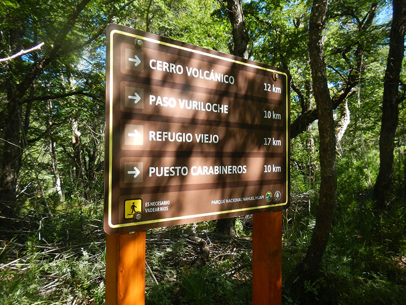
This lower part of the trail is pretty closed with bamboo. After roughly an hour you have to wade through the Cauquenes creek. Here the trail starts to climb more steadily. There will be a junction, take a right, the left one goes towards La Rosada lagoon and Volcánico peak.
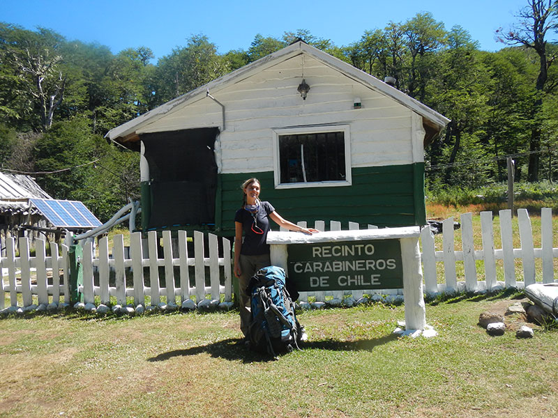
Continue hiking up to the Vuriloche pass, from here contour around the huge marsh open area, cross a small creek and you are at the Carabineros (Chilean Border Police). Here you must do your paperwork into Chile and let them know you are heading to sleep up at the hut.
IMPORTANT: Normally, the carabineros are there only in January and February and are open until 18 hs ( 6 pm.) Camping is allowed in this point.
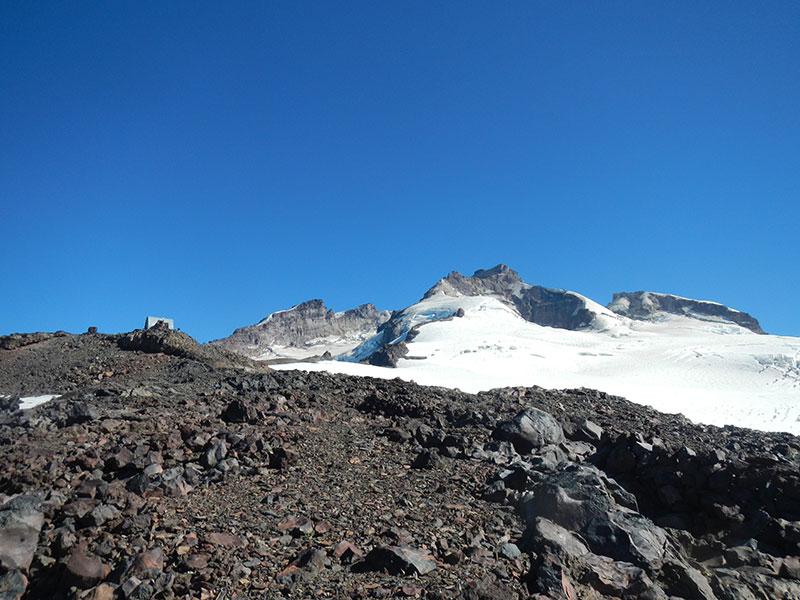
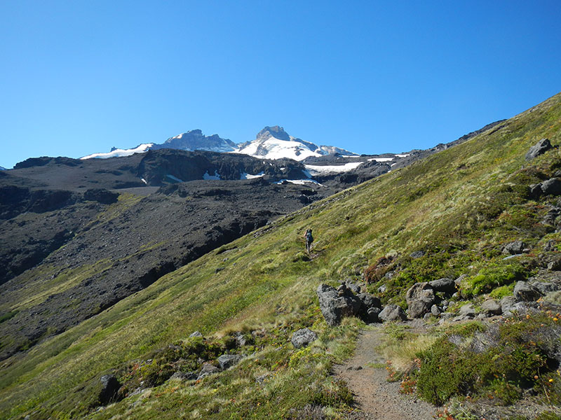
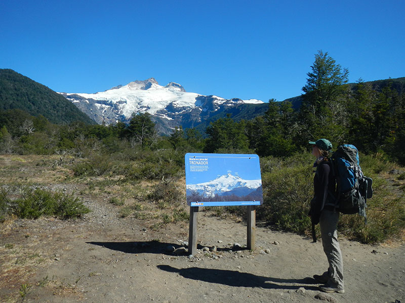
The trail continues well marked and steadily up, the first 45 minutes in the lenga forest and then on the open rocky trail. Early in the season some of the markings may be covered with snow so not that easy to recognize. Roughly 3 hs. up from Carabineros to the hut which is visible up on the ridge on the last rocky outcrop before entering the Manso glacier. There is a stretch of very wet marshy grass to traverse so have some spare shoes to change into later.
The trail up to the Chilean border has plenty of places for water, not as many from Carabineros up and may be pretty dry so plan accordingly. Up at the hut you may find some snow melting over the rocks or have to melt snow. Be sure to take extra warm layer as it is pretty windy and gets very cold at night.
Follow the same trail back down to Pampa Linda.
To improve the trekking experience, it is recommended to contact a Mountain Guide authorized by the AAGM (Argentine Association of Mountain Guides)
PHOTO GALLERY